Kesselberg Pass
Kesselbergstraße
Germany · Bavaria (Bavarian Alps)
858m
Key Facts
- Elevation
- 858m
- Route length
- 8 km
- Max gradient
- 10%
- Hairpins
- 10
- Driving difficulty
- Moderate (2/5)
- Surface
- Good
- Open
- Year-round
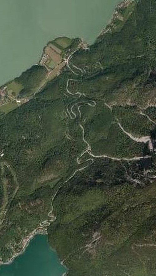
Route & Map
Loading map
Route
SKochel am See
8 km · max 10%
▲Kesselberg Pass (858m)
Descent
EWalchensee
A winding road connecting the Kochelsee with the Walchensee in the Bavarian Alps. Famous among motorcyclists for its tight hairpin bends and as the site of historic hill climb races in the early 20th century.
Weather & Conditions
Driving Experience
Elevation Profile
↑420m gain
↓221m loss
625m → 879m → 824m
Difficulty
Moderate
2/5 — car driving difficulty
Based on steepness, elevation gain, hairpins, road length & surface quality
Hairpin Turns
10
Plenty of switchbacks to test your line
When to Drive
Year-round (best: July - September)
- ›Open year-round, though winter conditions may require snow equipment.
- ›Morning hours offer the best driving conditions with less traffic.
Coordinates
- Summit
- 47.6216°N, 11.3492°E
- Start (Kochel am See)
- 47.6547°N, 11.3647°E
- End (Walchensee)
- 47.5904°N, 11.3115°E
#motorcycling#hairpins#historic#hill-climb
Explore More
Image: "Datenquelle: Bayerische Vermessungsverwaltung – www.geodate / CC BY 3.0 de