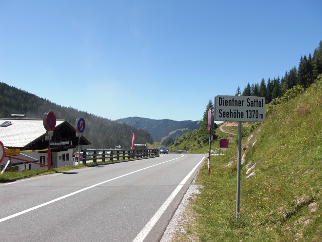
Dientner Sattel
Austria · Salzburg
1,357m
Key Facts
- Elevation
- 1,357m
- Route length
- 18 km
- Max gradient
- 10%
- Hairpins
- 2
- Driving difficulty
- Moderate (2/5)
- Surface
- Good
- Open
- Year-round
Route & Map
Loading map
Route
SBischofshofen
18 km · max 10%
▲Dientner Sattel (1,357m)
Descent
EDienten am Hochkönig
Connects Bischofshofen in the Salzachtal with Dienten and the Hochkönig area. Named after the mighty Hochkönig massif (2,941m) towering above. Part of a scenic route through the Salzburg mountains.
Weather & Conditions
Driving Experience
Elevation Profile
↑916m gain
↓285m loss
559m → 1,370m → 1,190m
Difficulty
Moderate
2/5 — car driving difficulty
Based on steepness, elevation gain, hairpins, road length & surface quality
Hairpin Turns
2
A few tight turns to keep it interesting
When to Drive
Year-round (best: July - September)
- ›Open year-round, though winter conditions may require snow equipment.
- ›Morning hours offer the best driving conditions with less traffic.
Coordinates
- Summit
- 47.3833°N, 13.0167°E
- Start (Bischofshofen)
- 47.4167°N, 13.2167°E
- End (Dienten am Hochkönig)
- 47.3833°N, 13.0167°E
#year-round#hochkönig#scenic
Explore More
Image: Ulflulfl / CC BY-SA 3.0