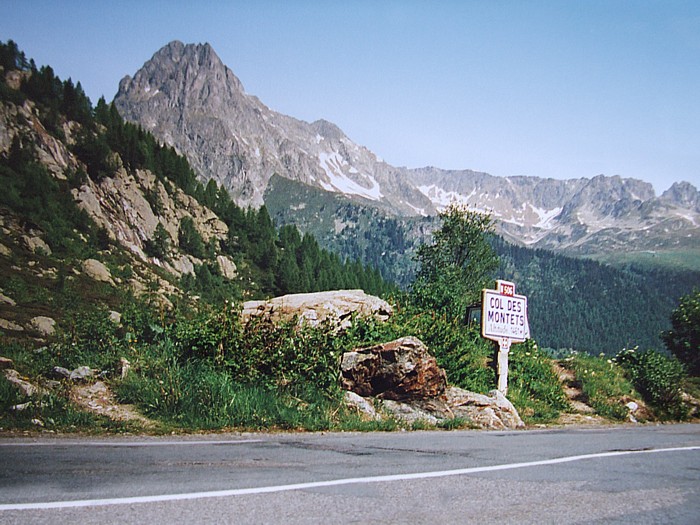
Col des Montets
France · Haute-Savoie
1,461m
Key Facts
- Elevation
- 1,461m
- Route length
- 14 km
- Max gradient
- 8%
- Hairpins
- 5
- Driving difficulty
- Moderate (2/5)
- Surface
- Good
- Open
- Year-round (may close in heavy snow)
Route & Map
Loading map
Route
SChamonix
14 km · max 8%
▲Col des Montets (1,461m)
Descent
EVallorcine
Pass in the Mont Blanc massif connecting Chamonix to Vallorcine and Switzerland. Passes through the Aiguilles Rouges nature reserve with spectacular Mont Blanc views.
Weather & Conditions
Driving Experience
Elevation Profile
↑436m gain
↓222m loss
1,045m → 1,462m → 1,259m
Difficulty
Moderate
2/5 — car driving difficulty
Based on steepness, elevation gain, hairpins, road length & surface quality
Hairpin Turns
5
A few tight turns to keep it interesting
When to Drive
Year-round (best: July - September)
- ›Open year-round, though winter conditions may require snow equipment.
- ›Morning hours offer the best driving conditions with less traffic.
Coordinates
- Summit
- 46.0006°N, 6.9253°E
- Start (Chamonix)
- 45.9237°N, 6.8694°E
- End (Vallorcine)
- 46.0336°N, 6.9336°E
#mont-blanc#nature-reserve#scenic
Explore More
Image: No machine-readable author provided. Idéfix~commonswiki assumed (based on copyright claims). / CC BY-SA 3.0